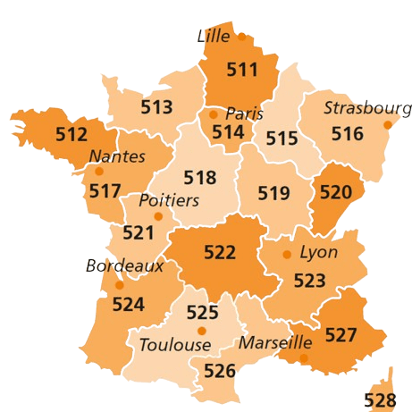
Normandie – Regional Map Michelin 513
6,95€ incl. tax 6,59€ ex. tax
The ideal Michelin map for a ROUND TRIP to explore the Normandie region at a scale of 1:200,000 (1 cm = 2 km), allowing you to plan your itinerary without missing the essentials, choose your stops and enjoy a few detours.
Enjoy the clarity and reliability of Michelin maps, with details of petrol stations, rest areas and danger zones (steep slopes, difficult or dangerous routes, height restrictions), recommended routes and intuitive legends.
Bilingual Edition (French/English)
Made in Italy
- Category : Atlases and maps, France regional map, Regional maps, Road maps


